Tracking down the old Malta Railway – Part Three

A few years ago whilst fiddling around in Facebook, I came across a group called ‘The Malta Railway’ and was surprised to see that they had well over 1000 members! Not bad for a railway that has no tracks and hasn’t seen a train for over eighty years. I joined the group in the hope that I could find out a bit more about the remains of the railway system and particularly the tunnels at each end of the single track. See my earlier posts about the Malta railway here and here.

The entrances to the tunnel between Valletta and Floriana have been blocked for many years by chained iron gates and limestone blocks. I have read messages on the internet from people who have managed to find ways into the tunnel and have been sorely tempted to give it a try myself but… that would be trespassing (and anyway, I am far too fat to squeeze through the railings). Imagine my delight one day in September when I read an announcement from the Facebook group’s admin – Paul Galea, that he would be leading tours of the tunnel and Floriana station on the 23rd of October 2011. I booked my flight to Malta immediately.

When I got to the Floriana local council building for the 10.00 tour there was already a large crowd of people waiting. They were not your usual train spotters – not an anorak in sight despite the damp October weather.

First stop was the ticket office tucked away next to the Methodist Church. Here Paul Galea explained that the normal entrance to the station was via a door and a set of stairs that were now blocked off. We followed him down the ramps that offered alternative access and would have been reserved for military personel other ‘special cases’. As we made our way down towards the station level, it was clear that a great deal of debris and rubbish had been allowed to accumulate on the site over the last 80 years. It was also clear from the grafitti on the limestone walls that there had been a steady stream of ‘unofficial’ visitors to the station over the years.

The station area itself had been provided with fairly bright temporary lighting powered by a portable generator. Originally the entire station area would have been lit by candles!

Paul did a tremendous job explaining something of the history of the railway and of the station itself. At one stage during the talk when covering the wartime use of the station as an air raid shelter, an elderly gentleman interupted and explained that as a 10 year old, he was one of those who lived and slept in the tunnel during the war years. He told us how two rooms (behind the bricked up passage to the ticket office) were set aside as classrooms as teachers tried in vain to make their voices heard above the din of the people living in the tunnel. To be honest I am not much of a railway buff and this account of the station’s ‘human history’ was at least as interesting to me as the technical details of the steam trains and the rolling stock.

Not part of the original equipment but nevertheless impossible to ignore were the huge bundles of high tension electricity and telephone cables. Paul explained that the parts of the tunnel that were not accessible to the public were strewn with discarded cable drums and other debris. If the station was ever to be returned to it’s original appearance it would be an enormous (and expensive) job to conceal these cables . Personally, I doubt that anyone would have an deep enough pockets for this sort of work BUT I would love to be proved wrong.

After we had spent a while in the tunnel, we returned to the entrance and were shown the small magazine (with it’s own external access), which was used by the British military to guard the tunnel. It was from here also that ammunition could be loaded onto the train for transport to the Victoria Lines in the event of an invasion.

Beyond the magazine, the railway enters another short tunnel before emerging in the Notre Dame ditch. This section is not currently accessible and houses the remains of the wartime telephone switching equipment.

My thanks to Paul Galea and the Floriana local council for this unique opportunity to travel back in time. Perhaps one day we will see other parts of the Malta Railway opened to the public. I would love to walk underground from Floriana to Valletta or perhaps between Notabile and Museum Stations at the other end of the line!

A walk around the oldest buildings in the world

Note: This post was originally written before the covers were erected over the temples.

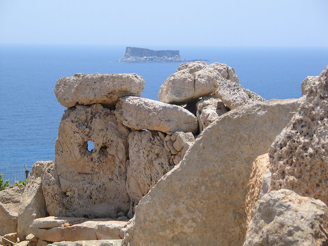
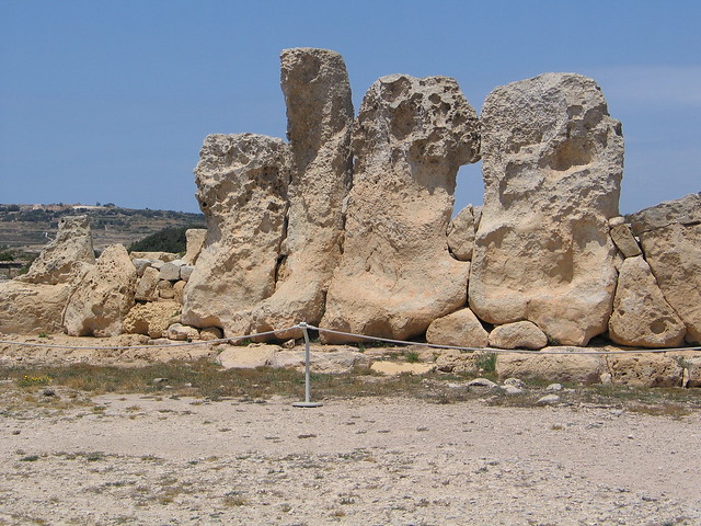
The Maltese Islands are rich in Neolithic sites. Ggantija in Gozo, Tarxien, and the Hagar Qim/Mnajdra complex here on Malta’s south coast are perhaps the most well known. These piles of stones are some of the earliest known man made structures in the world. They are showing their age a bit but what would you expect for buildings that are five and and a half thousand years old. My house was built in the year 2000 and is already looking a little frayed round the edges. These temples are older than the pyramids!

Mnajdra and Hagar Qim are currently being covered by new canopies that will minimise further damage by the elements. Of course this is the right thing to do but it is likely to destroy some of the atmosphere of this incredible, wild and atmospheric place.

139_3995

139_3972

In my opinion the temples are best seen after the visitors have left. Come with me for a late afternoon walk down the hill past Hagar Qim towards the Mnajdra complex. There are chain link fences around the temples now but we can ignore those and try to image why Malta’s earliest inhabitants went to the trouble of building these structures on this windy and barren hillside.

The sun is setting over Africa 200 hundred miles away. When we reach Mnajdra, let’s sit down and wait for that ‘plop’ when the sun and the sea merge in a soft orange haze. The rocks are still warm and the dusty wild thyme smells the same as it did to our distant ancestors that built this place.

G9LZ9522

Of course the temples would have looked rather different in their heyday. They may have been decorated with pigments and possibly even roofed with animal hides or other materials. Who knows? We do know that they were a altered and added to over a 1000 or so year period. Watch this short YouTube clip from my ‘Malta by Microlight’ DVD and imagine…

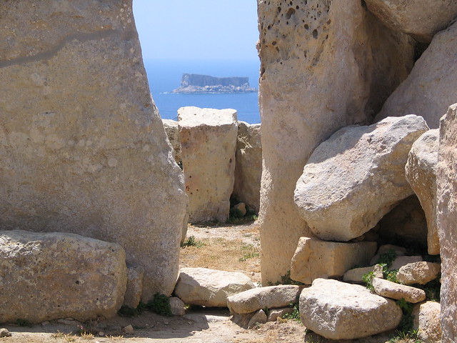
From Mnajdra, you can see the small flat-topped island of Filfla. It is rather tatty round the edges having been damaged by an earthquake in 1856 and (probably more seriously) by having been used as target practice by the Royal Airforce and the Navy. Despite this, Filfla is now a nature reserve and home to many interesting species.

Getting to Mnajdra and Hagar Qim is easiest if you have a car. Alternatively, if you don’t mind a hike, you could get a bus to Qrendi (3 km away) or Zurrieq (5 km away) and walk from there. Warning: although the distances are not too great, walking several kilometers in the Maltese sun can be very strenuous and possibly dangerous. Take water and sunscreen.

139_3976

Consult the map below for details. If you click on the ‘Google’ logo on the bottom left of the map, Google Maps will open in a new window and you can work out how to get to the temples from your specific location.

Tracking down the old Malta Railway – Part Two

In an earlier post I described a walk along the first mile or so of the Malta Railway from Valletta to Floriana. Recently I had the chance to explore the other end of the line at Mdina where it terminated. Armed with a printed copy of Don Gaunt’s guide to walking the old Malta Railway, I got off the bus in Rabat and followed Don’s directions through Mdina to the ‘hole in the wall’ and the ramp that leads down towards Museum Station. Actually I had expected the station to be right outside the city wall but in fact it was a couple of hundred meters down the road towards Mtarfa.

100_0213

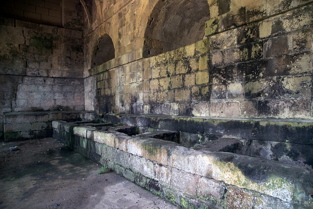
On the way to the station, I came across a fantastic derelict and crumbling public washhouse. I have seen a similar building in Gozo on the road between Victoria and Xlendi and I guess that there must have been others back in the days before mains water and automatic washing machines. A sign outside warned in English and Maltese that the building was unsafe and should not be entered. Large cracks in the walls lent credibility to this assertion but, the presence of a group of small children splashing around in the stone basins inside suggested that the locals were either fearless or unable to read.

Mdina Station


Mdina Wash house

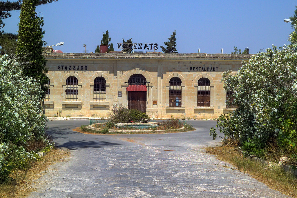
Continuing down the hill, I came to Museum Station, totally deserted, boarded up and bearing the scars of recent vandalism. A few years ago the station building was used as a restaurant. It has a great location – perhaps one day it will reopen.

Update: Summer 2014. Restoration works on the the station building are well advanced and it looks like a new restaurant will indeed be opened on the site.

Mdina Station3


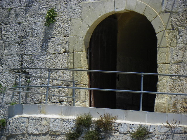
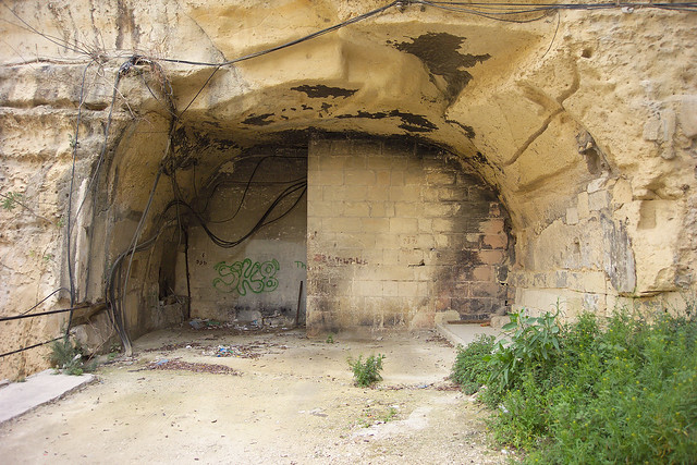
Just to the east of the station building is a fenced off compound. From here you can see (just) the arch where the tunnel exits from underneath the city of Mdina.

Mdina railway tunnel

After mooching around Museum Staion for a bit longer and taking lots more photos I refered once again to Don’s notes and continued my exploration at Notabile station – only a kilometer away (as the train chuffs) but a stiff walk for me in the hot June sun.

The only remaining evidence of Notabile Station is the ticket office on Triq it Tigrija. Unfortunately I had some problems with my camera so photos will have to wait until my next visit. Behind the ticket office, a rubble strewn path leads towards the place where the railway line would have disappeared under Mdina. I followed it for 20 – 30 metres and got a tantalising glimpse of the fenced off tunnel entrance. Whilst I was trying to sort out my camera a couple of barking dogs started up and I decided to back off.

What sort of state is the 1000 metre tunnel under Mdina in today? If anybody knows, I would love to hear from them.

Check out Google maps to get to

Museum Station……

…and Notabile ticket office….

Tracking down the old Malta Railway – Part One

UPDATE: This post was originally written several years ago – before the construction work on the new City Gate in Valletta. The tunnel exit from Valletta station, and bridge across the ditch, now look very different.

I first read about the Malta Railway in Nicholas Monserrats book, “The Kapillan of Malta”. This book was mostly set during the second world war and manages to weave a great deal of Maltese history into the story of ‘Dun Salv’ and his troglodyte parishioners.

The steam railway was opened in 1883 and ran from Valletta to Mdina. It lurched from financial crisis to financial crisis for the next 48 years and was almost forgotten by Dun Salv’s day. At the time of writing this, 78 years after the railway ceased to exist, there are still traces if you know where to look.

I didn’t know where to look but luckily a bit of googling turned up an excellent guide to “Walking the old Malta Railway” by Don Gaunt. Armed with a printed copy of this, I set out to walk the first few kilometers of the railway. I was only in Malta for a weekend so the rest of the route would have to wait for my next visit.

Crossing the bridge in front of Valletta’s city gate you can look down to your right and see the low arches of another bridge, emerging from a tunnel and crossing the Great Ditch that was part of Valletta’s ancient fortifications. Access to this level is via an unmarked door and a steep set of steps close to the tourist information office, just inside the city gate. Try to ignore the strong smell of urine and make your way down to the bottom of the steps. A garage now occupies the site of the original station.

valletta_railway8

Cross the bridge to the other side of the ditch and you will find the tunnel entrance has been sealed with limestone blocks and an iron gate.

Malta_Railway4

When I visited, the gate was loosely secured with a chain and padlock. If I had been considerably thinner and armed with a powerful flashlight, I might have been tempted to squeeze betwen the gates and investigate further.

Malta_Railway5

As it was, I retraced my steps up to the Valletta bus terminus and followed Mr Gaunt’s directions to Floriana.

The path of the tunnel is apparently interupted by the large underground car park next to the RAF memorial. It continues underneath the narrow gardens next to the square in front of Floriana’s parish church. Who knows what state the tunnels are in these days. I would love to find out!

Gardens in Floriana

Don Gaunt’s guide locates the remains of Floriana railway staion close to the end of these gardens. He notes that in 1995 there was a demolition order posted. I was unable to find the station so presumably the order has been carred out. From here, I wandered down to the left and joined the main road into Valletta. Not far along this busy road is the Porte de Bombes, and to the right of this is the Notre Dame Ditch where, after about a kilometer of inky blackness, the tunnel finally emerges into the Maltese sunlight. Of course, this entrance is also sealed.

Malta_Railway16

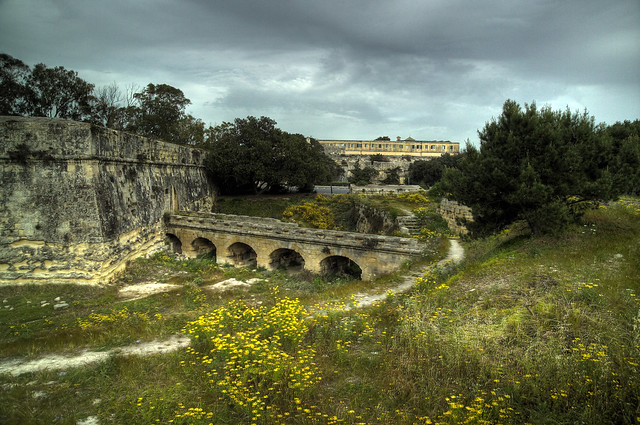
Now we are at the last row of Valletta’s defences, the so-called “Fausse Bray” Here the little trains passed through one more set of ramparts before crossing the low ditch on a stone viaduct to continue their journey towards Hamrun. My journey stopped here this evening in this beautiful, overgrown, secluded place, a stonesthrow from Malta’s capital city. I will come back soon and resume my walk.

Old Malta railway viaduct